
1964 Map of Scotland SE
USGS Topo · Published 1967About this map
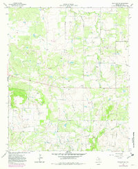
Oil production dominates the landscape of southern Clay County in the mid-1960s, defined by the extensive Mc Kinlay Oil Field and numerous scattered Oil Wells. The terrain is marked by a network of access roads and a prominent Pipeline cutting through the center of the sheet, supported by infrastructure like a Pumping Sta and Water Tank. While industrial activity is widespread, the map also identifies the localized ranching or residential area of Lazy B.
Find a feature on this map
12 named features on this map. Tap any name to fly to it.
Don’t see what you’re looking for? This feature index may not catch every label — zoom into the map to look around manually.
Map Details
Editions of this 1964 Scotland SE Map
2 editions found
Other maps of this area

1954 · Wichita Falls
USGS Topo · 1:250,000

1958 · Wichita Falls
USGS Topo · 1:250,000

1962 · Windthorst
USGS Topo · 1:24,000

1962 · Antelope Creek NE
USGS Topo · 1:24,000

1963 · Deer Creek
USGS Topo · 1:24,000

1963 · Scotland
USGS Topo · 1:24,000

1964 · Darnell Branch
USGS Topo · 1:24,000

1964 · Antelope
USGS Topo · 1:24,000
1964 · Postoak
USGS Topo · 1:24,000
1964 · Joy
USGS Topo · 1:24,000