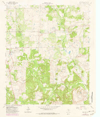
1964 Map of Antelope
USGS Topo · Published 1982About this map
Antelope and Shannon anchor the landscape of northern Jack County in the early 1960s, a region defined by its rugged drainages and the upper reaches of the West Fork Trinity River. The terrain is punctuated by significant elevations such as Backbone Mountain and Mount Lebo, while the presence of an Oil Field in the north indicates the region's mid-century energy production. For those tracing family roots, the map provides precise locations for the Antelope Cem and Shannon Cem, situated near their respective settlements. The drainage network is particularly dense here, with Lodge Creek, Hoefle Creek, and Willow Creek cutting through the woodland and pasture. A county line separating Clay and Jack counties runs through the northern portion of the quadrangle, passing near the small settlement of McKinlay.
Find a feature on this map
19 named features on this map. Tap any name to fly to it.
Don’t see what you’re looking for? This feature index may not catch every label — zoom into the map to look around manually.
Map Details
Editions of this 1964 Antelope Map
2 editions found
Other maps of this area

1954 · Wichita Falls
USGS Topo · 1:250,000

1958 · Wichita Falls
USGS Topo · 1:250,000

1962 · Windthorst
USGS Topo · 1:24,000

1962 · Antelope Creek NE
USGS Topo · 1:24,000

1964 · Johnson Lake
USGS Topo · 1:24,000

1964 · Darnell Branch
USGS Topo · 1:24,000

1964 · Lynn Creek
USGS Topo · 1:24,000

1964 · Antelope
USGS Topo · 1:24,000

1964 · Scotland SE
USGS Topo · 1:24,000
1964 · Postoak
USGS Topo · 1:24,000