
1964 Map of Lynn Creek
USGS Topo · Published 1967About this map
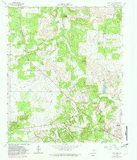
Squaw Mountain and the Indian Hills rise above the drainage basins of Jack County, where the landscape of the mid-1960s was defined by active extraction and rural transit. Extensive Oil Field operations and Gravel Pits dot the terrain, showing the industrial footprint alongside agricultural fence lines. The water network is particularly dense here, with Mc Donald Branch and Roper Branch feeding into larger systems like Cameron Creek and North Creek. An Old Railroad Grade cuts across the southern portion of the sheet, providing a clear path for genealogists and local historians to trace former transit corridors that once connected these remote Texas hills. Local social centers are anchored by the Lynn Creek Chapel and resting places such as the Roberts Branch Cem and Round Mountain Cem, which remain as fixed points in an otherwise shifting landscape of petroleum development and changing ranch boundaries.
Find a feature on this map
19 named features on this map. Tap any name to fly to it.
Don’t see what you’re looking for? This feature index may not catch every label — zoom into the map to look around manually.
Map Details
Editions of this 1964 Lynn Creek Map
2 editions found
Other maps of this area

1954 · Wichita Falls
USGS Topo · 1:250,000

1958 · Wichita Falls
USGS Topo · 1:250,000

1960 · Jacksboro
USGS Topo · 1:24,000

1962 · Antelope Creek NE
USGS Topo · 1:24,000

1964 · Senate
USGS Topo · 1:24,000

1964 · Johnson Lake
USGS Topo · 1:24,000

1964 · Darnell Branch
USGS Topo · 1:24,000

1964 · Bryson
USGS Topo · 1:24,000

1964 · Antelope
USGS Topo · 1:24,000
1964 · Postoak
USGS Topo · 1:24,000