
1964 Map of Bryson
USGS Topo · Published 1967About this map
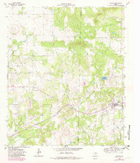
The town of Bryson sits at the heart of this mid-1960s landscape, positioned along the Chicago Rock Island and Pacific railroad line. The settlement's infrastructure is clearly marked, showing the local High Sch, a Refinery, and a Water Tank, reflecting its dual role as a community center and industrial hub for the surrounding countryside. This region of North Texas is heavily defined by the energy sector, specifically the Knox Oil Field and the numerous Oil Wells peppered across the terrain.
Find a feature on this map
22 named features on this map. Tap any name to fly to it.
Don’t see what you’re looking for? This feature index may not catch every label — zoom into the map to look around manually.
Map Details
Editions of this 1964 Bryson Map
2 editions found
Other maps of this area

1924 · Graham 4-d
USGS Topo · 1:48,000

1927 · Graham
USGS Topo · 1:62,500

1954 · Wichita Falls
USGS Topo · 1:250,000

1958 · Wichita Falls
USGS Topo · 1:250,000

1964 · Senate
USGS Topo · 1:24,000

1964 · Loving
USGS Topo · 1:24,000

1964 · Lake Eddleman
USGS Topo · 1:24,000

1964 · Lynn Creek
USGS Topo · 1:24,000
1964 · Markley
USGS Topo · 1:24,000
1967 · Long Hollow
USGS Topo · 1:24,000