
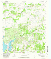
1964 Map of Lake Eddleman
USGS Topo · Published 1967About this map
Lake Eddleman and Lake Graham dominate the southwestern portion of this mid-1960s landscape, providing a clear view of the water resources supporting the nearby community of Graham. The map details an active energy and industrial landscape, specifically highlighting the Ligon Oil Field, Flint Oil Field, and James Oil Field dotted with numerous oil wells and crossing pipelines. On the shore of the reservoir, the Graham Power Plant and the Radio Tower (KSWA) stand as modern landmarks of the era.
Find a feature on this map
21 named features on this map. Tap any name to fly to it.
Don’t see what you’re looking for? This feature index may not catch every label — zoom into the map to look around manually.
Map Details
Editions of this 1964 Lake Eddleman Map
2 editions found
Other maps of this area

1924 · Graham 4-d
USGS Topo · 1:48,000

1925 · Graham 4-c
USGS Topo · 1:48,000

1927 · Graham
USGS Topo · 1:62,500

1954 · Wichita Falls
USGS Topo · 1:250,000

1958 · Wichita Falls
USGS Topo · 1:250,000

1964 · Newcastle
USGS Topo · 1:24,000

1964 · True
USGS Topo · 1:24,000

1964 · Loving
USGS Topo · 1:24,000

1964 · Bryson
USGS Topo · 1:24,000
1964 · Markley
USGS Topo · 1:24,000