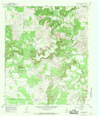
1967 Map of Long Hollow
USGS Topo · Published 1970About this map
The rugged ranch lands of northern Texas are meticulously detailed in this survey of the Long Hollow region. Defined by its deeply incised drainage systems, the landscape is dominated by the forks of Salt Creek, including West Salt Creek and East Salt Creek, which carve through the high ground. Notable elevations like Deck Mountain and Woolly provide significant landmarks for navigation across the brushy terrain.
Find a feature on this map
15 named features on this map. Tap any name to fly to it.
Don’t see what you’re looking for? This feature index may not catch every label — zoom into the map to look around manually.
Map Details
Editions of this 1967 Long Hollow Map
2 editions found
Other maps of this area

1891 · Palo Pinto
USGS Topo · 1:125,000

1918 · Palo Pinto
USGS Topo · 1:125,000

1924 · Palo Pinto 2-b
USGS Topo · 1:48,000

1924 · Palo Pinto 2-a
USGS Topo · 1:48,000

1924 · Palo Pinto 1-b
USGS Topo · 1:48,000

1927 · Pickwick
USGS Topo · 1:62,500

1927 · Mineral Wells
USGS Topo · 1:62,500

1954 · Abilene
USGS Topo · 1:250,000

1954 · Wichita Falls
USGS Topo · 1:250,000

1958 · Wichita Falls
USGS Topo · 1:250,000