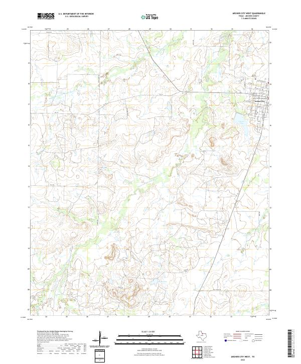
2022 Map of Archer City West
USGS Topo · Published 2022About this map
Archer City sits on the eastern edge of this Texas landscape, serving as the civic anchor for the surrounding ranch and oil country. The town grid is centered on the Archer County Courthouse, with nearby local landmarks including the Archer City Cem and residential streets like W Main St and W Chestnut St. This region is defined by the hydrologic network of the Wichita River system, where the Middle Fork Little Wichita River and S Fork Little Wichita River wind through the terrain. To the south and west of the city, significant water bodies like Carver Lake and Ikard Lake break up the open country, which is traversed by a network of rural roads such as FM 2178 and Devils Drop Rd. The map illustrates the distribution of stock tanks and seasonal drainages like Dogwood Cr that support the area's agricultural heritage.
Find a feature on this map
35 named features on this map. Tap any name to fly to it.
Don’t see what you’re looking for? This feature index may not catch every label — zoom into the map to look around manually.
Map Details
Editions of this 2022 Archer City West Map
This is the sole edition of this map. No revisions or reprints were ever made.
Other maps of this area

1931 · Archer City
USGS Topo · 1:62,500

1932 · Dundee
USGS Topo · 1:62,500

1954 · Wichita Falls
USGS Topo · 1:250,000

1958 · Wichita Falls
USGS Topo · 1:250,000
1963 · Archer City NE
USGS Topo · 1:24,000

1963 · Archer City East
USGS Topo · 1:24,000

1964 · Bobcat Bluff
USGS Topo · 1:24,000

1964 · Dundee SE
USGS Topo · 1:24,000

1964 · Archer City West
USGS Topo · 1:24,000
1964 · Prickly Pear Branch
USGS Topo · 1:24,000