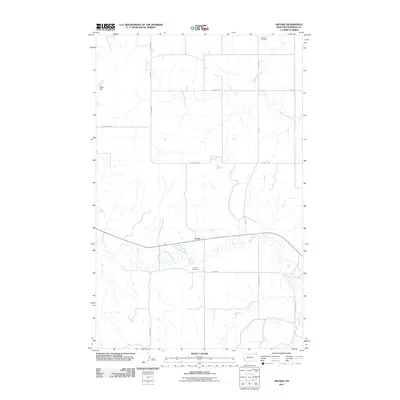
2011 Map of Archer
USGS Topo · Published 2011About this map
Big Muddy Creek meanders through this portion of Sheridan County, carving a wide floodplain that defines the local geography. The small settlement of Archer sits just north of the creek, serving as a focal point for the surrounding agricultural community. The landscape is marked by a network of rural roads such as Grants Rd and Bolster Rd, which connect remote farmsteads to local landmarks.
Find a feature on this map
17 named features on this map. Tap any name to fly to it.
Don’t see what you’re looking for? This feature index may not catch every label — zoom into the map to look around manually.
Map Details
Editions of this 2011 Archer Map
This is the sole edition of this map. No revisions or reprints were ever made.
Other maps of this area

1954 · Wolf Point
USGS Topo · 1:250,000

1958 · Wolf Point
USGS Topo · 1:250,000

1983 · Plentywood NW
USGS Topo · 1:24,000
1983 · Daleview
USGS Topo · 1:24,000

1983 · Outlook
USGS Topo · 1:24,000

1983 · Redstone
USGS Topo · 1:24,000

1983 · Kisler Butte
USGS Topo · 1:24,000

1983 · Soo NW
USGS Topo · 1:24,000

1983 · Archer
USGS Topo · 1:24,000
1983 · Soo NE
USGS Topo · 1:24,000