
1983 Map of Plentywood NW
USGS Topo · Published 1983About this map
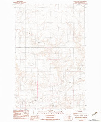
The northern edge of Sheridan Co, Montana, meets the international border in this 1983 study, highlighting the rural transition into Surprise Valley Rural Municipality No 9, Saskatchewan. The landscape is defined by the drainage patterns of Plentywood Creek as it winds through the southern portion of the quadrangle, joined further east by the smaller Harrys Creek. This map, based on 1974 aerial photography and 1977 field checks, documents a sparsely populated agricultural and ranching frontier where the primary infrastructure consists of isolated section roads and a solitary Air Strip. The terrain is characterized by the subtle relief of the northern plains, showing the relationship between small watercourses and the broad prairie topography along the Canada United States boundary.
Find a feature on this map
7 named features on this map. Tap any name to fly to it.
Don’t see what you’re looking for? This feature index may not catch every label — zoom into the map to look around manually.
Map Details
Editions of this 1983 Plentywood NW Map
This is the sole edition of this map. No revisions or reprints were ever made.
Other maps of this area

1954 · Wolf Point
USGS Topo · 1:250,000

1958 · Wolf Point
USGS Topo · 1:250,000

1983 · Outlook
USGS Topo · 1:24,000

1983 · Archer
USGS Topo · 1:24,000

1983 · Plentywood
USGS Topo · 1:24,000

1983 · Raymond
USGS Topo · 1:24,000
1983 · Plentywood SW
USGS Topo · 1:24,000
2011 · Plentywood SW
USGS Topo · 1:24,000
2011 · Plentywood
USGS Topo · 1:24,000
2011 · Plentywood NW
USGS Topo · 1:24,000