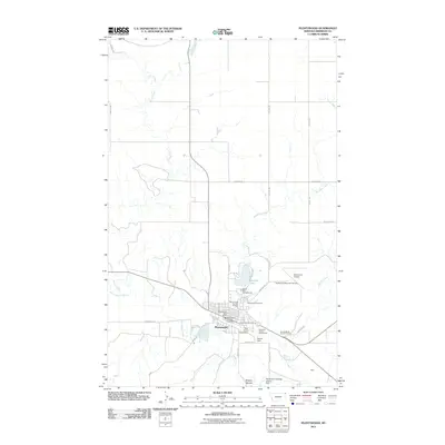
2011 Map of Plentywood
USGS Topo · Published 2011About this map
Plentywood serves as the hub of this Sheridan County landscape, where the confluence of several water systems dictates the local geography. The town is situated near the junction of Big Muddy Creek, Boxelder Creek, and McCoy Creek, reflecting the importance of water management in this prairie environment. This is evidenced by infrastructure like the Box Elder Creek Dam and the Marsh Dam, alongside community spaces such as the Sheridan County Fairgrounds and the Sunset Movie Drive-in Theatre.
Find a feature on this map
35 named features on this map. Tap any name to fly to it.
Don’t see what you’re looking for? This feature index may not catch every label — zoom into the map to look around manually.
Map Details
Editions of this 2011 Plentywood Map
This is the sole edition of this map. No revisions or reprints were ever made.
Other maps of this area

1948 · Antelope
USGS Topo · 1:24,000

1949 · Antelope
USGS Topo · 1:24,000

1950 · Shippe Canyon
USGS Topo · 1:24,000

1954 · Wolf Point
USGS Topo · 1:250,000

1958 · Wolf Point
USGS Topo · 1:250,000

1983 · Plentywood NW
USGS Topo · 1:24,000

1983 · Dooley
USGS Topo · 1:24,000

1983 · Dooley SW
USGS Topo · 1:24,000

1983 · Kisler Butte
USGS Topo · 1:24,000

1983 · Plentywood
USGS Topo · 1:24,000