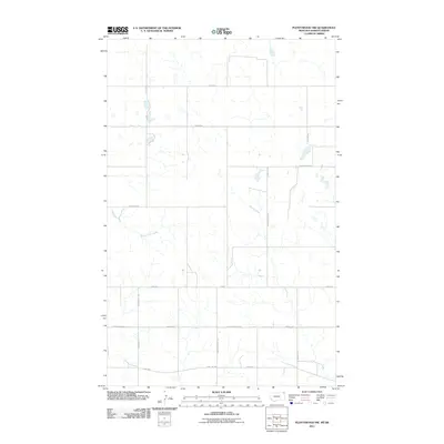
2011 Map of Plentywood NW
USGS Topo · Published 2011About this map
Soo Line tracks cut across the southern reaches of this landscape on the Montana-Saskatchewan border, where the High Plains transition into the rolling topography of the Outlook Bench. The drainage patterns are defined by the winding courses of Plentywood Creek and Harrys Creek, which carve through a network of section-line roads and family-named landmarks. This 2011 survey by the U.S. Geological Survey documents the rural infrastructure of the region, where gravel routes such as Chalk Butte Rd, Hendrickson Hill Rd, and Chance Rd connect isolated homesteads and grazing lands. The map illustrates a contemporary view of the international boundary area, emphasizing the persistent grid of the homestead era as it remains integrated with the historic Soo Line Rd corridor and local landmarks like Chalk Butte.
Find a feature on this map
19 named features on this map. Tap any name to fly to it.
Don’t see what you’re looking for? This feature index may not catch every label — zoom into the map to look around manually.
Map Details
Editions of this 2011 Plentywood NW Map
This is the sole edition of this map. No revisions or reprints were ever made.
Other maps of this area

1954 · Wolf Point
USGS Topo · 1:250,000

1958 · Wolf Point
USGS Topo · 1:250,000

1983 · Plentywood NW
USGS Topo · 1:24,000

1983 · Outlook
USGS Topo · 1:24,000

1983 · Archer
USGS Topo · 1:24,000

1983 · Plentywood
USGS Topo · 1:24,000

1983 · Raymond
USGS Topo · 1:24,000
1983 · Plentywood SW
USGS Topo · 1:24,000
2011 · Plentywood SW
USGS Topo · 1:24,000
2011 · Plentywood
USGS Topo · 1:24,000