
1983 Map of Raymond
USGS Topo · Published 1983About this map
Raymond and the Raymond Port of Entry define this borderland landscape in Sheridan County, where the high plains meet the international boundary. Surveyed in the mid-1970s and early 1980s, the terrain is characterized by a dense network of prairie potholes and wetlands, including Mattson Slough, Lochin Slough, and Syme Slough. This map documents the remote northern frontier where Saskatchewan and Montana meet, showing the sparse but vital transport links and local landmarks like McCoy Creek. The presence of a Gravel Pit and scattered improved roads suggests the steady, small-scale infrastructure required to maintain this port of entry. For the genealogist or local historian, it provides an exact placement of the small settlement of Raymond before decades of change in the northern plains.
Find a feature on this map
10 named features on this map. Tap any name to fly to it.
Don’t see what you’re looking for? This feature index may not catch every label — zoom into the map to look around manually.
Map Details
Editions of this 1983 Raymond Map
This is the sole edition of this map. No revisions or reprints were ever made.
Other maps of this area

1954 · Wolf Point
USGS Topo · 1:250,000

1958 · Wolf Point
USGS Topo · 1:250,000

1983 · Plentywood NW
USGS Topo · 1:24,000

1983 · Dooley
USGS Topo · 1:24,000

1983 · Dooley SW
USGS Topo · 1:24,000

1983 · Plentywood
USGS Topo · 1:24,000
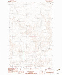
1983 · Plentywood SW
USGS Topo · 1:24,000
2011 · Dooley
USGS Topo · 1:24,000
2011 · Plentywood SW
USGS Topo · 1:24,000
2011 · Dooley SW
USGS Topo · 1:24,000