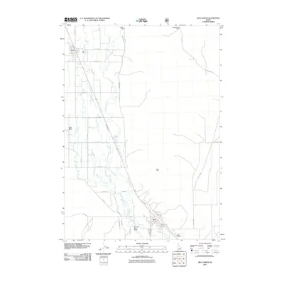
2011 Map of Arco North
USGS Topo · Published 2011About this map
Arco and the Big Lost River Valley define the landscape of this Idaho interior, where irrigation infrastructure is as prominent as the natural waterways. The movement of water across this arid basin is meticulously documented through a network of man-made features like the Arco Canal, Island Ditch, and East Side Ditch. These systems parallel the Big Lost River as it flows past the small settlements of Moore and Lost River, illustrating the intensive management of resources required for agriculture in the high desert. To the east, the terrain rises sharply toward Arco Peak and the passage at Beaverland Pass, marking the transition from the flat valley floor to the foothills of the surrounding mountains. The presence of Hillcrest Cemetery southeast of the main settlement provides a specific point of interest for those researching local family histories in this part of Butte County.
Find a feature on this map
33 named features on this map. Tap any name to fly to it.
Don’t see what you’re looking for? This feature index may not catch every label — zoom into the map to look around manually.
Map Details
Editions of this 2011 Arco North Map
This is the sole edition of this map. No revisions or reprints were ever made.
Other maps of this area

1955 · Idaho Falls
USGS Topo · 1:250,000

1958 · Idaho Falls
USGS Topo · 1:250,000

1969 · Darlington
USGS Topo · 1:24,000

1969 · Arco Pass
USGS Topo · 1:24,000

1969 · Ramshorn Canyon
USGS Topo · 1:24,000

1972 · Arco North
USGS Topo · 1:24,000

1972 · Arco South
USGS Topo · 1:24,000

1972 · Butte City
USGS Topo · 1:24,000

1972 · Nichols Reservoir
USGS Topo · 1:24,000

1972 · Arco Hills
USGS Topo · 1:24,000