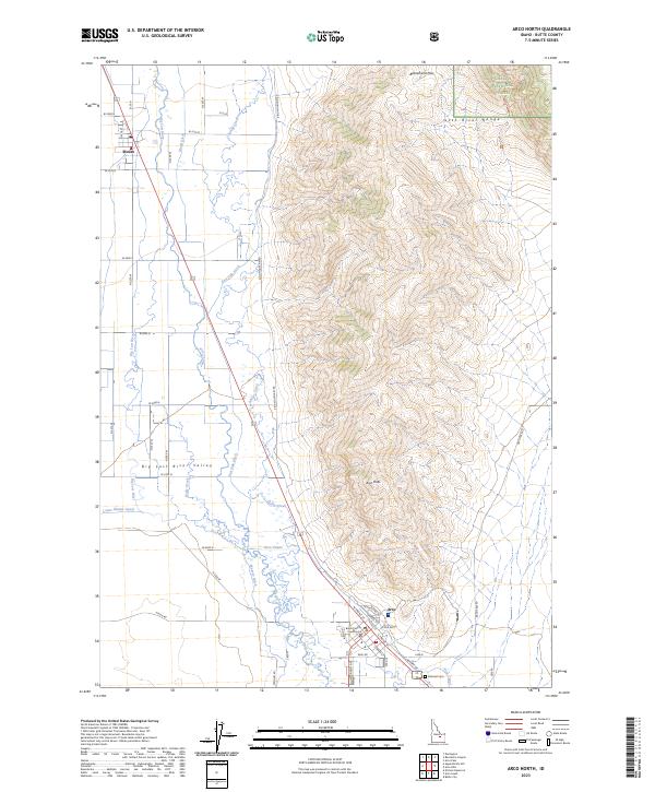
2023 Map of Arco North
USGS Topo · Published 2023About this map
Arco and the village of Moore anchor this survey of the eastern Big Lost River Valley, where the high peaks of the Lost River Range meet the valley floor. The landscape is defined by an intricate network of irrigation engineering, including the Arco Canal, Munsey Ditch, and Island Ditch, which divert water from the Big Lost River to support agriculture in this arid high-desert environment. These watercourses trace the settlement patterns established long before modern mapping, following the natural contours of the land beneath the looming Arco Peak.
Find a feature on this map
55 named features on this map. Tap any name to fly to it.
Don’t see what you’re looking for? This feature index may not catch every label — zoom into the map to look around manually.
Map Details
Editions of this 2023 Arco North Map
This is the sole edition of this map. No revisions or reprints were ever made.
Other maps of this area

1955 · Idaho Falls
USGS Topo · 1:250,000

1958 · Idaho Falls
USGS Topo · 1:250,000

1969 · Darlington
USGS Topo · 1:24,000

1969 · Arco Pass
USGS Topo · 1:24,000

1969 · Ramshorn Canyon
USGS Topo · 1:24,000

1972 · Arco North
USGS Topo · 1:24,000

1972 · Arco South
USGS Topo · 1:24,000

1972 · Butte City
USGS Topo · 1:24,000

1972 · Nichols Reservoir
USGS Topo · 1:24,000

1972 · Arco Hills
USGS Topo · 1:24,000