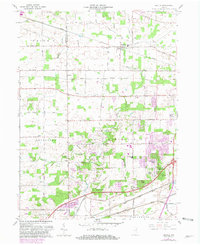
1961 Map of Arcola
USGS Topo · Published 1981About this map
The town of Arcola and its surrounding townships define this landscape on the boundary of Allen and Whitley Counties. Recorded in the early 1960s with revisions through the turn of the 1980s, the map documents a period of significant suburban expansion west of Fort Wayne. Residential developments like Liberty Hills, Parkway Hills, and Rolling Hills appear as modern subdivisions encroaching on the established agricultural grid. These newer neighborhoods contrast with the older railroad-oriented character of Arcola and the small settlement at Dunfee.
Find a feature on this map
53 named features on this map. Tap any name to fly to it.
Don’t see what you’re looking for? This feature index may not catch every label — zoom into the map to look around manually.
Map Details
Editions of this 1961 Arcola Map
2 editions found
Other maps of this area

1953 · Fort Wayne
USGS Topo · 1:250,000

1953 · Muncie
USGS Topo · 1:250,000

1955 · Columbia City
USGS Topo · 1:24,000

1956 · Muncie
USGS Topo · 1:250,000

1956 · Fort Wayne
USGS Topo · 1:250,000

1956 · Fort Wayne West
USGS Topo · 1:24,000

1956 · Huntington
USGS Topo · 1:24,000

1957 · Huntertown
USGS Topo · 1:24,000

1957 · Churubusco
USGS Topo · 1:24,000

1961 · Arcola
USGS Topo · 1:24,000