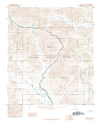
1983 Map of Arctic C-1
USGS Topo · Published 1984About this map
Old Woman Creek meanders through this portion of the Arctic National Wildlife Refuge, where the vast topography of the North Slope is captured in this 1983 provisional edition. The landscape is defined by its lack of human infrastructure, focusing instead on the complex drainage patterns and elevation contours of the Brooks Range foothills. A prominent Wilderness Boundary bisects the terrain, indicating the transition between different management zones within the protected area. Compiled from 1974 aerial photography, the map serves as a snapshot of this remote Alaskan interior before later shifts in environmental policy and climate began to alter the permafrost and hydrologic systems of the high north.
Find a feature on this map
3 named features on this map. Tap any name to fly to it.
Don’t see what you’re looking for? This feature index may not catch every label — zoom into the map to look around manually.
Map Details
Editions of this 1983 Arctic C-1 Map
This is the sole edition of this map. No revisions or reprints were ever made.
Other maps of this area

1951 · Arctic
USGS Topo · 1:250,000

1951 · Table Mountain
USGS Topo · 1:250,000

1956 · Table Mountain
USGS Topo · 1:250,000

1956 · Arctic
USGS Topo · 1:250,000

1964 · Table Mountain
USGS Topo · 1:250,000
1972 · Table Mountain B-5
USGS Topo · 1:63,360

1983 · Arctic B-2
USGS Topo · 1:63,360
1983 · Table Mountain C-5
USGS Topo · 1:63,360
1983 · Arctic D-2
USGS Topo · 1:63,360

1983 · Arctic C-2
USGS Topo · 1:63,360