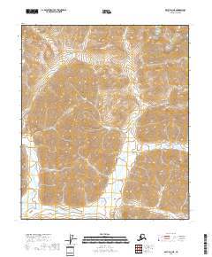
2018 Map of Arctic D-1 NE
USGS Topo · Published 2018About this map
E Fork Chandalar River courses through this section of the North Slope, carving a deep drainage through the mountainous interior of the t5s r34e and t6s r34e townships. The topography is defined by sharp elevation shifts and steep-walled valleys, where the East Fork Chandalar River serves as the primary hydrological feature. This 2018 survey illustrates a landscape without named settlements or infrastructure, highlighting the extreme isolation of this arctic corridor. The map provides a precise record of the natural landforms and watercourses, reflecting the character of the Alaska wilderness prior to any modern development or road construction in this specific quadrangle.
Find a feature on this map
6 named features on this map. Tap any name to fly to it.
Don’t see what you’re looking for? This feature index may not catch every label — zoom into the map to look around manually.
Map Details
Editions of this 2018 Arctic D-1 NE Map
This is the sole edition of this map. No revisions or reprints were ever made.
Other maps of this area

1951 · Demarcation Point
USGS Topo · 1:250,000

1951 · Arctic
USGS Topo · 1:250,000

1951 · Table Mountain
USGS Topo · 1:250,000

1951 · Mt. Michelson
USGS Topo · 1:250,000

1955 · Demarcation Point
USGS Topo · 1:250,000

1956 · Table Mountain
USGS Topo · 1:250,000

1956 · Arctic
USGS Topo · 1:250,000

1956 · Mt. Michelson
USGS Topo · 1:250,000

1964 · Table Mountain
USGS Topo · 1:250,000

1964 · Demarcation Point
USGS Topo · 1:250,000