
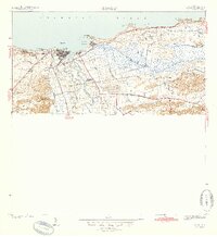
1942 Map of Arecibo
USGS Topo · Published 1942About this map
The industrial sugar landscape of northern Puerto Rico centers on the massive Central Cambalache facility, situated along the meandering banks of the Rio Grande de Arecibo. This 1940 survey reveals an economy deeply tied to the sugar trade and coastal transit, evidenced by the extensive network of the American RR which connects the primary city of Arecibo with rural outposts like Estacion Cambalache.
Find a feature on this map
45 named features on this map. Tap any name to fly to it.
Don’t see what you’re looking for? This feature index may not catch every label — zoom into the map to look around manually.
Map Details
Editions of this 1942 Arecibo Map
2 editions found
Other maps of this area

1938 · Camuy
USGS Topo · 1:20,000

1942 · Camuy
USGS Topo · 1:30,000

1942 · Barceloneta
USGS Topo · 1:30,000

1943 · Utuado NE
USGS Topo · 1:10,000

1946 · Barceloneta
USGS Topo · 1:30,000

1946 · Utuado
USGS Topo · 1:30,000

1946 · Bayaney
USGS Topo · 1:30,000

1946 · Arecibo
USGS Topo · 1:30,000

1946 · Florida
USGS Topo · 1:30,000
1947 · Barceloneta SO
USGS Topo · 1:10,000