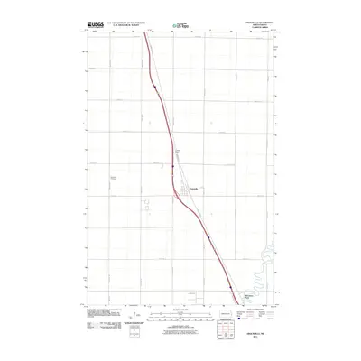
2011 Map of Argusville
USGS Topo · Published 2011About this map
Argusville serves as the central hub of this agricultural landscape in Cass County, situated alongside a corridor of major transportation routes. The settlement's grid is oriented around County Rd 81 and Northern Dr, reflecting the typical layout of Red River Valley communities that developed in tandem with regional transit lines. To the northwest, the Argusville Cemetery stands as a significant point for genealogical research, marking the local heritage of the area. The map also identifies Lisburg Field and Brooktree Park, indicating the community's local infrastructure and recreational spaces. The surrounding terrain is defined by a precise section-line road system, including 20th St SE and 171st Ave SE, which underscores the deep-rooted importance of large-scale farming in this part of North Dakota.
Find a feature on this map
22 named features on this map. Tap any name to fly to it.
Don’t see what you’re looking for? This feature index may not catch every label — zoom into the map to look around manually.
Map Details
Editions of this 2011 Argusville Map
This is the sole edition of this map. No revisions or reprints were ever made.
Other maps of this area

1895 · Fargo
USGS Topo · 1:125,000

1895 · Casselton
USGS Topo · 1:125,000

1897 · Fargo
USGS Topo · 1:125,000

1897 · Casselton
USGS Topo · 1:125,000

1952 · Grand Forks
USGS Topo · 1:250,000

1953 · Fargo
USGS Topo · 1:250,000

1956 · Fargo
USGS Topo · 1:250,000

1956 · Grand Forks
USGS Topo · 1:250,000

1959 · Fargo North
USGS Topo · 1:24,000

1959 · West Fargo
USGS Topo · 1:24,000