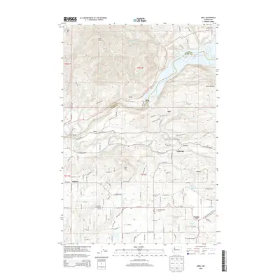
2013 Map of Ariel
USGS Topo · Published 2013About this map
Lake Merwin and the Lewis River form a natural boundary between Cowlitz and Clark counties in this Pacific Northwest landscape. The area is characterized by a transition from the water-level settlements of Ariel and Etna to the high ground of Davis Peak and Green Mountain. Genealogists will find the locations of Lone Pine Cem and Mtn View Cem useful for family research, while the presence of La Center View-Air Airport and Mc Clellan Field Airport reflects the rural aviation history of the region. The map reveals a network of small communities like Amboy, Dayton, and Cedarville, connected by established routes such as NE Pup Creek Rd and NE Fargher Lake Hwy. Moving south, the terrain levels into the vicinity of Fargher Lake and the Tsugawa Brothers Reservoir, showing the distribution of rural residences and the agricultural footprint of these upland valleys.
Find a feature on this map
74 named features on this map. Tap any name to fly to it.
Don’t see what you’re looking for? This feature index may not catch every label — zoom into the map to look around manually.
Map Details
Editions of this 2013 Ariel Map
This is the sole edition of this map. No revisions or reprints were ever made.
Other maps of this area

1919 · Mount St Helens
USGS Topo · 1:125,000

1940 · La Center
USGS Topo · 1:62,500

1941 · Yacolt
USGS Topo · 1:62,500

1943 · Pigeon Springs
USGS Topo · 1:62,500

1948 · Vancouver
USGS Topo · 1:250,000

1950 · Vancouver
USGS Topo · 1:250,000

1950 · Vancouver
USGS Topo · 1:250,000

1953 · Hoquiam
USGS Topo · 1:250,000

1953 · Pigeon Springs
USGS Topo · 1:62,500

1953 · Cougar
USGS Topo · 1:62,500