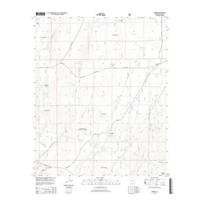
2014 Map of Aripine
USGS Topo · Published 2014About this map
Aripine serves as the focal point of this high-altitude landscape atop the Mogollon Plateau. The terrain is defined by a sophisticated network of drainage washes and water management features essential for life in this arid environment, including Decker Wash, Phoenix Park Wash, and Bagnall Wash. A significant portion of the land is situated within the Sitgreaves National Forest, where the topography is dotted with numerous named stock tanks and watering holes such as Reidhead Tank, Owens Tank, and Exchange Tank. Transportation across the plateau is facilitated by State Hwy 277 and State Hwy 260, connecting the small settlement to more distant locales. Local landmarks like Oklahoma Flat Draw and Rice Seeps highlight the area's reliance on unique hydrological features for ranching and forest management.
Find a feature on this map
59 named features on this map. Tap any name to fly to it.
Don’t see what you’re looking for? This feature index may not catch every label — zoom into the map to look around manually.
Map Details
Editions of this 2014 Aripine Map
This is the sole edition of this map. No revisions or reprints were ever made.
Other maps of this area

1886 · Holbrook
USGS Topo · 1:250,000

1893 · Holbrook
USGS Topo · 1:250,000

1954 · Holbrook
USGS Topo · 1:250,000

1957 · Holbrook
USGS Topo · 1:250,000

1958 · Holbrook
USGS Topo · 1:250,000

1960 · Holbrook
USGS Topo · 1:250,000

1961 · Clay Springs
USGS Topo · 1:62,500

1961 · Heber
USGS Topo · 1:62,500

1970 · Red Knoll
USGS Topo · 1:24,000
1971 · Zeniff
USGS Topo · 1:24,000