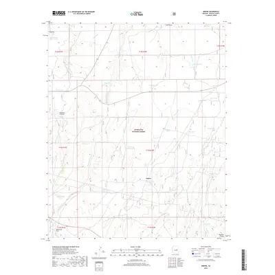
2018 Map of Aripine
USGS Topo · Published 2018About this map
The high-desert ranching landscape of the Mogollon Plateau is the focus of this Navajo County survey, centered on the historic settlement of Aripine. Located within the boundaries of the Sitgreaves National Forest, the region is defined by a dense network of seasonal drainage systems and livestock infrastructure. Numerous family-named and functional water sources, such as Oklahoma Flat Draw, Mikes Tank, and Headquarters Tank, suggest a land used primarily for grazing and cattle operations. The map details the intersection of state routes 277, 377, and 260, which provide the primary access through this remote highland. Long-established waterways like Pierce Wash and Phoenix Park Wash cut through the terrain, while landmarks like Rice Seeps indicate the vital importance of natural water points in this arid environment.
Find a feature on this map
51 named features on this map. Tap any name to fly to it.
Don’t see what you’re looking for? This feature index may not catch every label — zoom into the map to look around manually.
Map Details
Editions of this 2018 Aripine Map
This is the sole edition of this map. No revisions or reprints were ever made.
Other maps of this area

1886 · Holbrook
USGS Topo · 1:250,000

1893 · Holbrook
USGS Topo · 1:250,000

1954 · Holbrook
USGS Topo · 1:250,000

1957 · Holbrook
USGS Topo · 1:250,000

1958 · Holbrook
USGS Topo · 1:250,000

1960 · Holbrook
USGS Topo · 1:250,000

1961 · Clay Springs
USGS Topo · 1:62,500

1961 · Heber
USGS Topo · 1:62,500

1970 · Red Knoll
USGS Topo · 1:24,000
1971 · Zeniff
USGS Topo · 1:24,000