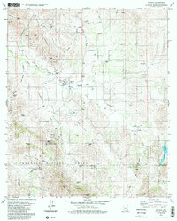
1979 Map of Arivaca
USGS Topo · Published 1985About this map
Mining and ranching define the landscape of Arivaca and its surrounding desert foothills in the late 1970s. The settlement's history is deeply connected to mineral extraction, visible through numerous workings like the Backbone Mine, Amado Mine, and the Edwards Mine. Water remains the critical resource for these operations and local life, evidenced by the Arivaca Coop Water Wells and a network of tanks and springs such as Fraguita Spring and Caviglia Tank.
Find a feature on this map
62 named features on this map. Tap any name to fly to it.
Don’t see what you’re looking for? This feature index may not catch every label — zoom into the map to look around manually.
Map Details
Editions of this 1979 Arivaca Map
2 editions found
Other maps of this area

1920 · Arivaca
USGS Topo · 1:125,000

1921 · Old Glory
USGS Topo · 1:125,000

1939 · Tubac
USGS Topo · 1:62,500

1941 · Arivaca
USGS Topo · 1:62,500

1942 · Ruby
USGS Topo · 1:62,500

1942 · Oro Blanco
USGS Topo · 1:62,500

1943 · Arivaca
USGS Topo · 1:62,500

1943 · Old Glory
USGS Topo · 1:125,000

1943 · Tubac
USGS Topo · 1:62,500

1944 · Oro Blanco
USGS Topo · 1:62,500