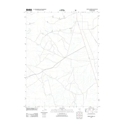
2012 Map of Arizona Spring
USGS Topo · Published 2012About this map
The Hastings Cutoff crosses this high desert landscape, tracing a segment of the alternative route used by mid-19th-century emigrants on the California Trail. The presence of water sources like Arizona Spring, Clark Spring, and Government Spring highlights the critical importance of reliable hydration in this arid Elko County environment. These points of interest, along with the Government Corral, suggest the area's ongoing utility for livestock management and remote travel.
Find a feature on this map
15 named features on this map. Tap any name to fly to it.
Don’t see what you’re looking for? This feature index may not catch every label — zoom into the map to look around manually.
Map Details
Editions of this 2012 Arizona Spring Map
This is the sole edition of this map. No revisions or reprints were ever made.
Other maps of this area

1935 · Halleck
USGS Topo · 1:125,000

1953 · Spruce Mountain
USGS Topo · 1:62,500

1955 · Elko
USGS Topo · 1:250,000

1958 · Elko
USGS Topo · 1:250,000

1962 · Elko
USGS Topo · 1:250,000

1965 · Elko
USGS Topo · 1:250,000

1968 · Snow Water Lake
USGS Topo · 1:24,000
1969 · Secret Valley
USGS Topo · 1:24,000
1969 · Gordon Creek
USGS Topo · 1:24,000
1984 · Arizona Spring
USGS Topo · 1:24,000