
1968 Map of Snow Water Lake
USGS Topo · Published 1971About this map
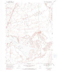
Clover Valley dominates this high-desert landscape in northeastern Nevada, where seasonal drainage and terminal basins dictate the geography. The prominent basin of Snow Water Lake sits at the center of the sheet, fed by several ephemeral watercourses including Wiseman Creek and Johnson Creek. The mapping reveals a land shaped by drainage patterns, with The Slough and Steele Creek winding through the northern sections near the base of Black Ridge. Human activity is sparse but evident along the corridor of Route 93, which cuts through the northwestern corner of the quadrangle near the Gravel Pit. The map is particularly useful for understanding the hydrologic history of the region before modern land-use changes, capturing the complex network of depressions and creeks like Warm Cr that define this interior drainage system.
Find a feature on this map
14 named features on this map. Tap any name to fly to it.
Don’t see what you’re looking for? This feature index may not catch every label — zoom into the map to look around manually.
Map Details
Editions of this 1968 Snow Water Lake Map
2 editions found
Other maps of this area

1935 · Halleck
USGS Topo · 1:125,000

1953 · Spruce Mountain
USGS Topo · 1:62,500

1955 · Elko
USGS Topo · 1:250,000

1958 · Elko
USGS Topo · 1:250,000

1962 · Elko
USGS Topo · 1:250,000

1965 · Elko
USGS Topo · 1:250,000

1968 · Ventosa
USGS Topo · 1:24,000
1968 · Snow Water Lake NE
USGS Topo · 1:24,000
1968 · Tobar
USGS Topo · 1:24,000
1969 · Humboldt Peak
USGS Topo · 1:24,000