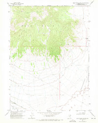
1968 Map of Snow Water Lake NE
USGS Topo · Published 1971About this map
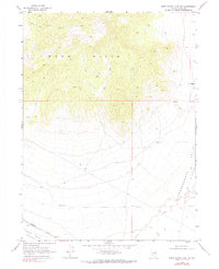
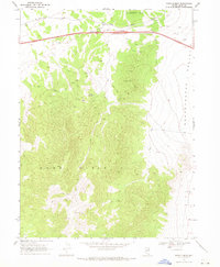
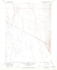
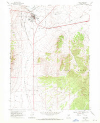
Wood Hills dominate the northern terrain of this Elko County quadrangle, where the high desert landscape drops away into the vast Independence Valley (Depression) and Clover Valley (Depression). The map records a sparsely settled ranching and transit landscape in the late 1960s, anchored by the Warm Springs Ranch on the eastern edge. This area is defined by its water sources and the vital transportation corridor running along the valley floor, where the Western Pacific railroad tracks parallel a network of unimproved roads and a Jeep Trail.
Find a feature on this map
8 named features on this map. Tap any name to fly to it.
Don’t see what you’re looking for? This feature index may not catch every label — zoom into the map to look around manually.
Map Details
Editions of this 1968 Snow Water Lake NE Map
2 editions found
Other maps of this area

1955 · Wells
USGS Topo · 1:250,000

1955 · Elko
USGS Topo · 1:250,000

1958 · Wells
USGS Topo · 1:250,000

1958 · Elko
USGS Topo · 1:250,000

1961 · Wells
USGS Topo · 1:250,000

1962 · Elko
USGS Topo · 1:250,000

1965 · Elko
USGS Topo · 1:250,000
1968 · Moor Summit
USGS Topo · 1:24,000
1968 · Independence Valley SW
USGS Topo · 1:24,000
1968 · Wells
USGS Topo · 1:24,000