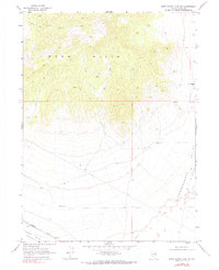
1968 Map of Snow Water Lake NE
USGS Topo · Published 1989About this map
Wood Hills dominate the northern terrain of this Elko County quadrangle, transitioning into the broad basins of Independence Valley (Depression) and Clover Valley (Depression) to the south. The 1960s landscape is defined by its sparse high-desert infrastructure, where a network of Jeep Trails provides the primary access through the upland drainages. Human activity is clustered around essential water sources, most notably at the Warm Springs Ranch and various unnamed springs that dot the eastern slopes.
Find a feature on this map
10 named features on this map. Tap any name to fly to it.
Don’t see what you’re looking for? This feature index may not catch every label — zoom into the map to look around manually.
Map Details
Editions of this 1968 Snow Water Lake NE Map
2 editions found
Other maps of this area

1955 · Wells
USGS Topo · 1:250,000

1955 · Elko
USGS Topo · 1:250,000

1958 · Wells
USGS Topo · 1:250,000

1958 · Elko
USGS Topo · 1:250,000

1961 · Wells
USGS Topo · 1:250,000

1962 · Elko
USGS Topo · 1:250,000

1965 · Elko
USGS Topo · 1:250,000

1968 · Moor Summit
USGS Topo · 1:24,000

1968 · Independence Valley SW
USGS Topo · 1:24,000

1968 · Wells
USGS Topo · 1:24,000