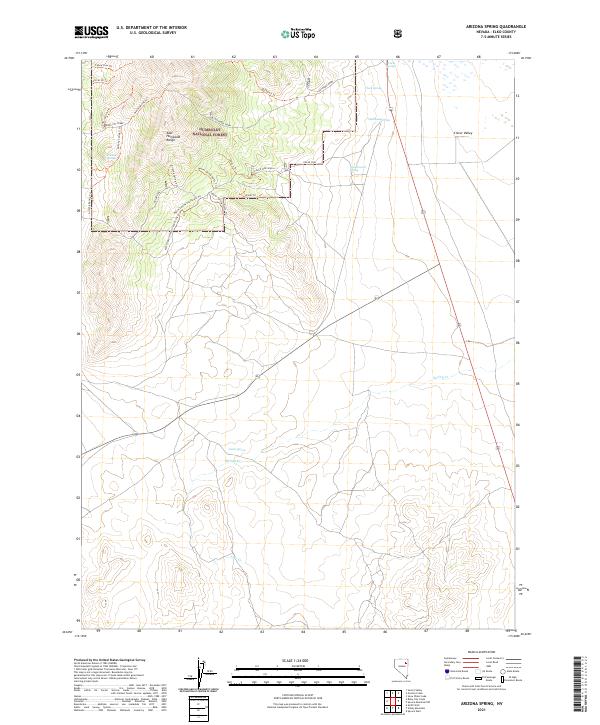
2021 Map of Arizona Spring
USGS Topo · Published 2021About this map
The East Humboldt Range defines the high terrain of this portion of the Humboldt National Forest, where a network of springs and seasonal draws supports the arid environment of Elko County. Water sources like Arizona Spring, Government Spring, and Warm Springs are critical landmarks in a landscape marked by steep elevation changes and intricate trail systems. The eastern portion of the map descends into the Clover Valley, a significant geographical feature for local ranchers and historians tracking the development of this region.
Find a feature on this map
32 named features on this map. Tap any name to fly to it.
Don’t see what you’re looking for? This feature index may not catch every label — zoom into the map to look around manually.
Map Details
Editions of this 2021 Arizona Spring Map
This is the sole edition of this map. No revisions or reprints were ever made.
Other maps of this area

1935 · Halleck
USGS Topo · 1:125,000

1953 · Spruce Mountain
USGS Topo · 1:62,500

1955 · Elko
USGS Topo · 1:250,000

1958 · Elko
USGS Topo · 1:250,000

1962 · Elko
USGS Topo · 1:250,000

1965 · Elko
USGS Topo · 1:250,000

1968 · Snow Water Lake
USGS Topo · 1:24,000
1969 · Secret Valley
USGS Topo · 1:24,000
1969 · Gordon Creek
USGS Topo · 1:24,000
1984 · Arizona Spring
USGS Topo · 1:24,000