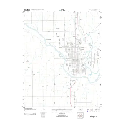
2012 Map of Arkansas City
USGS Topo · Published 2012About this map
The confluence of the Arkansas River and Walnut River anchors this study of Cowley County, where water and rail networks converge at the Arkansas City urban core. Industrial and transport infrastructure is prominently represented by the Burlington Northern Santa Fe Arkansas City Railyard, signaling the area's role as a regional transit hub. The surrounding landscape is heavily marked by energy extraction, with numerous named zones such as the Negro Creek Oil Field, Harvey Oil Field, and Geuda Springs Oil Field dotting the grid of rural roads.
Find a feature on this map
123 named features on this map. Tap any name to fly to it.
Don’t see what you’re looking for? This feature index may not catch every label — zoom into the map to look around manually.
Map Details
Editions of this 2012 Arkansas City Map
This is the sole edition of this map. No revisions or reprints were ever made.
Other maps of this area

1889 · Burden
USGS Topo · 1:125,000

1890 · Wellington
USGS Topo · 1:125,000

1935 · Kaw
USGS Topo · 1:62,500

1955 · Wichita
USGS Topo · 1:250,000

1955 · Enid
USGS Topo · 1:250,000

1958 · Enid
USGS Topo · 1:250,000

1958 · Wichita
USGS Topo · 1:250,000

1963 · Kaw City NW
USGS Topo · 1:24,000

1965 · Silverdale
USGS Topo · 1:24,000

1965 · Arkansas City
USGS Topo · 1:24,000