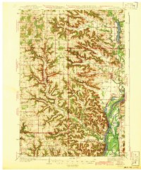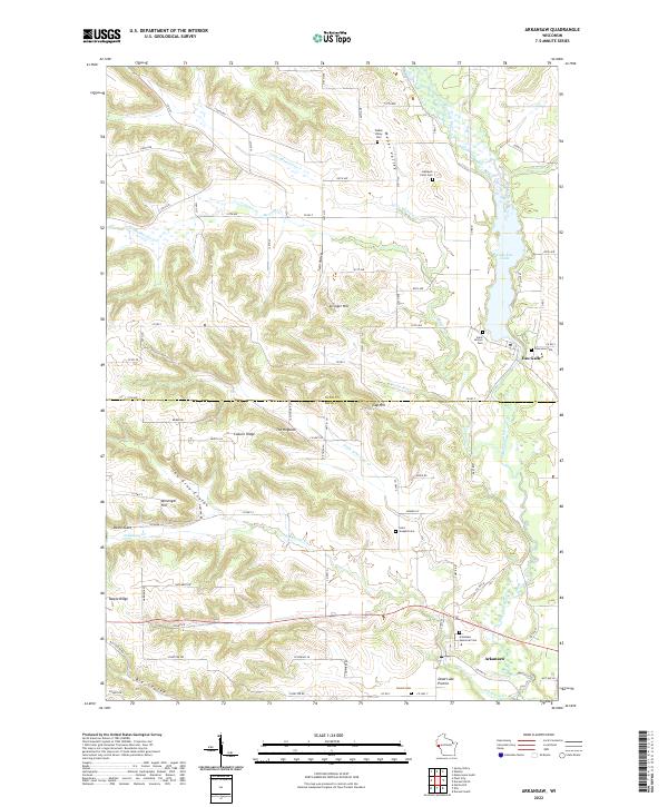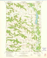
1972 Map of Arkansaw
USGS Topo · Published 1975About this map
Arkansaw and Eau Galle anchor this 1970s landscape, where the deeply dissected coulees and ridges of Pepin and Dunn counties create a rhythmic pattern of plateaus and valleys. The topography is defined by prominent features like Maple Ridge and Gap Hill, separated by a network of steep-walled ravines including Joe Gray Coulee and Big Coulee. The Eau Galle River dominates the eastern portion of the sheet, widening into Eau Galle Lake near Pine View Park, while smaller tributaries like Missouri Creek and Arkansaw Creek drain the western uplands.
Find a feature on this map
36 named features on this map. Tap any name to fly to it.
Don’t see what you’re looking for? This feature index may not catch every label — zoom into the map to look around manually.
Map Details
Editions of this 1972 Arkansaw Map
This is the sole edition of this map. No revisions or reprints were ever made.
Historical Maps of Eau Galle Through Time
5 maps found