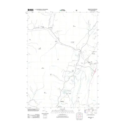
2012 Map of Arlington
USGS Topo · Published 2012About this map
Arlington Green Covered Bridge spans the Batten Kill in West Arlington, anchoring a landscape defined by its historic water crossings and mountain gaps. This modern survey details the village layout of East Arlington and Chiselville, where the Chiselville Covered Bridge continues to connect local routes across Roaring Br. The map reveals a high density of family and community burial grounds, from Matteson Cem and Saint James Cem near the river to Wilder Cem and Little Rhode Island Cem further south in Shaftsbury. Terrain features such as Red Mountain and Big Spruce Mountain overlook the drainage basins of Warm Brook and Fayville Br. The inclusion of Lake Shaftsbury and its associated Grove Picnic Shelter illustrates the area's continued reliance on its natural water bodies for recreation, while the numerous winding roads like Glastenbury Rd and Sandgate Rd trace the path of historic mountain transit.
Find a feature on this map
76 named features on this map. Tap any name to fly to it.
Don’t see what you’re looking for? This feature index may not catch every label — zoom into the map to look around manually.
Map Details
Editions of this 2012 Arlington Map
This is the sole edition of this map. No revisions or reprints were ever made.
Other maps of this area

1894 · Equinox
USGS Topo · 1:62,500

1895 · Cambridge
USGS Topo · 1:62,500

1896 · Equinox
USGS Topo · 1:62,500

1897 · Hoosick
USGS Topo · 1:62,500

1898 · Cambridge
USGS Topo · 1:62,500

1898 · Bennington
USGS Topo · 1:62,500

1900 · Taconic
USGS Topo · 1:125,000

1900 · Equinox
USGS Topo · 1:62,500

1901 · Cambridge
USGS Topo · 1:62,500

1903 · Mettawee
USGS Topo · 1:125,000