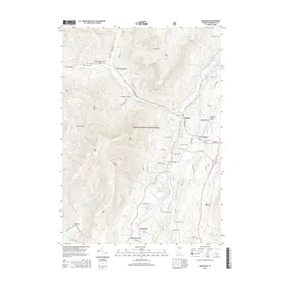
2015 Map of Arlington
USGS Topo · Published 2015About this map
Arlington and East Arlington sit at the intersection of the Batten Kill and Warm Brook, serving as focal points for this portion of Bennington County. The landscape is defined by the sharp rise of the Green Mountains to the east and significant peaks such as Big Spruce Mtn and Grass Mtn within the Green Mountain National Forest. Local history is preserved in landmark structures like the Arlington Green Covered Bridge and the Chiselville Covered Bridge, which span the region's prominent waterways. To the south, Shaftsbury and the residential area of Hidden Valley are positioned near Lake Shaftsbury and Millers Pond. The map reveals a high concentration of ancestral sites, including Saint James Cem, Evergreen Cem, and Matteson Cem, reflecting generations of settlement in the valley between West Mtn and the higher eastern ridges.
Find a feature on this map
73 named features on this map. Tap any name to fly to it.
Don’t see what you’re looking for? This feature index may not catch every label — zoom into the map to look around manually.
Map Details
Editions of this 2015 Arlington Map
This is the sole edition of this map. No revisions or reprints were ever made.
Other maps of this area

1894 · Equinox
USGS Topo · 1:62,500

1895 · Cambridge
USGS Topo · 1:62,500

1896 · Equinox
USGS Topo · 1:62,500

1897 · Hoosick
USGS Topo · 1:62,500

1898 · Cambridge
USGS Topo · 1:62,500

1898 · Bennington
USGS Topo · 1:62,500

1900 · Taconic
USGS Topo · 1:125,000

1900 · Equinox
USGS Topo · 1:62,500

1901 · Cambridge
USGS Topo · 1:62,500

1903 · Mettawee
USGS Topo · 1:125,000