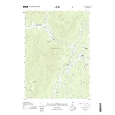
2018 Map of Arlington
USGS Topo · Published 2018About this map
Arlington and its outlying hamlets are defined by the winding course of the Batten Kill and the high elevations of the Green Mountain National Forest. This 2018 survey documents the enduring historic landmarks of Bennington County, notably the Arlington Green Covered Bridge and the Chiselville Covered Bridge, which serve as vital crossings in a landscape of narrow hollows and steep peaks.
Find a feature on this map
68 named features on this map. Tap any name to fly to it.
Don’t see what you’re looking for? This feature index may not catch every label — zoom into the map to look around manually.
Map Details
Editions of this 2018 Arlington Map
This is the sole edition of this map. No revisions or reprints were ever made.
Other maps of this area

1894 · Equinox
USGS Topo · 1:62,500

1895 · Cambridge
USGS Topo · 1:62,500

1896 · Equinox
USGS Topo · 1:62,500

1897 · Hoosick
USGS Topo · 1:62,500

1898 · Cambridge
USGS Topo · 1:62,500

1898 · Bennington
USGS Topo · 1:62,500

1900 · Taconic
USGS Topo · 1:125,000

1900 · Equinox
USGS Topo · 1:62,500

1901 · Cambridge
USGS Topo · 1:62,500

1903 · Mettawee
USGS Topo · 1:125,000