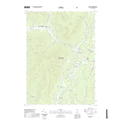
2021 Map of Arlington
USGS Topo · Published 2021About this map
The Batten Kill flows westward through the center of this terrain, serving as the historical axis for the settlements of Arlington, West Arlington, and East Arlington. This river valley is flanked by significant peaks, including Big Spruce Mtn and Red Mtn, which define the northern reaches of the Green Mountain National Forest. The map documents the enduring infrastructure of Bennington County, notably featuring the Arlington Green Covered Bridge and the Chiselville Covered Bridge at Chiselville. For genealogists, the landscape is marked by numerous family and community burial sites, from the Wilder Cem and Matteson Cem near the river to the Little Rhode Island Cem situated further south toward Shaftsbury. This distribution of cemeteries and small hamlets like Kansas illustrates the traditional Vermont pattern of village clusters separated by steep, forested hollows such as Benedict Hollow and Tidd Hollow.
Find a feature on this map
89 named features on this map. Tap any name to fly to it.
Don’t see what you’re looking for? This feature index may not catch every label — zoom into the map to look around manually.
Map Details
Editions of this 2021 Arlington Map
This is the sole edition of this map. No revisions or reprints were ever made.
Other maps of this area

1894 · Equinox
USGS Topo · 1:62,500

1895 · Cambridge
USGS Topo · 1:62,500

1896 · Equinox
USGS Topo · 1:62,500

1897 · Hoosick
USGS Topo · 1:62,500

1898 · Cambridge
USGS Topo · 1:62,500

1898 · Bennington
USGS Topo · 1:62,500

1900 · Taconic
USGS Topo · 1:125,000

1900 · Equinox
USGS Topo · 1:62,500

1901 · Cambridge
USGS Topo · 1:62,500

1903 · Mettawee
USGS Topo · 1:125,000