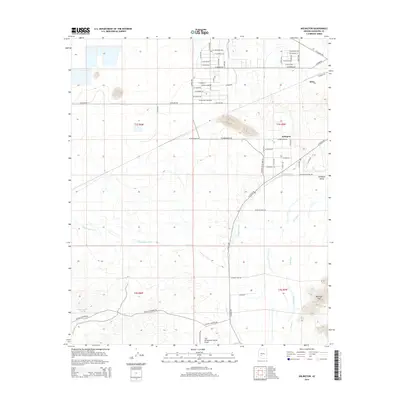
2014 Map of Arlington
USGS Topo · Published 2014About this map
Arlington and the surrounding Arlington Valley sit at the center of this landscape, defined by the critical irrigation infrastructure of the Arlington Canal. The map reveals a structured desert agricultural community where the grid of rural roads, such as W Elliot Rd and W Narramore Rd, meets the natural drainage of Luke Wash and the broad Gila River. In the northern section, the settlement of Dixie marks the transition toward more open terrain, while the southern reaches are bordered by the topographic rise of the Buckeye Hills. The presence of the Gila Compressor Station Airport and Sundance indicates the region's specialized utility and transportation roles. Local water management is further evidenced by features like Centennial Wash and Government Tank, which highlight the balance between development and the arid environment.
Find a feature on this map
52 named features on this map. Tap any name to fly to it.
Don’t see what you’re looking for? This feature index may not catch every label — zoom into the map to look around manually.
Map Details
Editions of this 2014 Arlington Map
This is the sole edition of this map. No revisions or reprints were ever made.
Other maps of this area

1951 · Cotton Center
USGS Topo · 1:62,500

1951 · Woolsey Peak
USGS Topo · 1:62,500

1954 · Phoenix
USGS Topo · 1:250,000

1957 · Phoenix
USGS Topo · 1:250,000

1958 · Phoenix
USGS Topo · 1:250,000

1958 · Buckeye NW
USGS Topo · 1:24,000

1958 · Hassayampa
USGS Topo · 1:24,000

1958 · Buckeye
USGS Topo · 1:62,500

1960 · Phoenix
USGS Topo · 1:250,000

1962 · Arlington
USGS Topo · 1:62,500