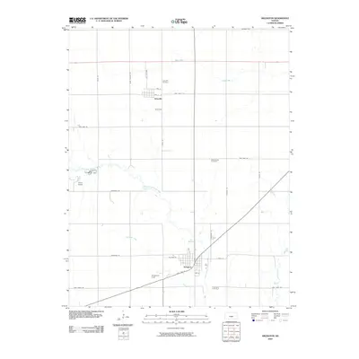
2009 Map of Arlington
USGS Topo · Published 2009About this map
Arlington and Abbyville anchor this agricultural landscape in Reno County, where the grid of rural section roads is interrupted only by the winding course of the North Fork Ninnescah River. The river bisects the southern half of the area, joined by tributaries such as Skinnawah Creek and Irish Creek. This 2009 survey highlights the intersection of transportation and community life, with State Hwy 61 cutting diagonally through the town of Arlington, passing near local landmarks like Baughman Field.
Find a feature on this map
31 named features on this map. Tap any name to fly to it.
Don’t see what you’re looking for? This feature index may not catch every label — zoom into the map to look around manually.
Map Details
Editions of this 2009 Arlington Map
This is the sole edition of this map. No revisions or reprints were ever made.
Other maps of this area

1892 · Kingman
USGS Topo · 1:125,000

1894 · Kingman
USGS Topo · 1:125,000

1894 · Lyons
USGS Topo · 1:125,000

1955 · Great Bend
USGS Topo · 1:250,000

1955 · Pratt
USGS Topo · 1:250,000

1957 · Great Bend
USGS Topo · 1:250,000

1958 · Great Bend
USGS Topo · 1:250,000

1959 · Pratt
USGS Topo · 1:250,000

1960 · Yaggy
USGS Topo · 1:24,000

1966 · Sterling SW
USGS Topo · 1:24,000