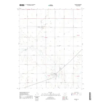
2018 Map of Arlington
USGS Topo · Published 2018About this map
Arlington and Abbyville anchor this 2018 survey of South Central Kansas, where the prairie landscape is defined by the winding course of the N Fork Ninnescah River and its tributaries. The map details a strictly organized agricultural grid, with long straight corridors like Sego Rd and Mills Ave connecting these rural hubs. Local heritage is preserved in the location of several burial grounds, including Abbyville Cem and Westminster Cem, which sit alongside the drainages of Sugar Cr and Irish Cr. The river valley itself creates a distinct diagonal break in the township and range survey lines, particularly where Skinnawah Cr joins the main river fork near Arlington. This modern study provides an exact record of the town plats for both settlements, including street-level detail from W Main St in Arlington to the residential blocks of Abbyville.
Find a feature on this map
46 named features on this map. Tap any name to fly to it.
Don’t see what you’re looking for? This feature index may not catch every label — zoom into the map to look around manually.
Map Details
Editions of this 2018 Arlington Map
This is the sole edition of this map. No revisions or reprints were ever made.
Other maps of this area

1892 · Kingman
USGS Topo · 1:125,000

1894 · Kingman
USGS Topo · 1:125,000

1894 · Lyons
USGS Topo · 1:125,000

1955 · Great Bend
USGS Topo · 1:250,000

1955 · Pratt
USGS Topo · 1:250,000

1957 · Great Bend
USGS Topo · 1:250,000

1958 · Great Bend
USGS Topo · 1:250,000

1959 · Pratt
USGS Topo · 1:250,000

1960 · Yaggy
USGS Topo · 1:24,000

1966 · Sterling SW
USGS Topo · 1:24,000