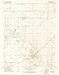
1971 Map of Arlington
USGS Topo · Published 1974About this map
The North Fork Ninnescah River meanders through the central Kansas plains, anchoring a landscape defined by small agricultural settlements and dual rail corridors during the early 1970s. The town of Arlington serves as a local hub at the junction of Skinnawah Creek and the river, where the Chicago Rock Island and Pacific railroad tracks bisect the community. Further north, the town of Abbyville sits along the Atchison Topeka and Santa Fe line, highlighting the critical role of rail transport in the regional economy. This survey documents a community tied to the land and tradition, featuring the Amish Ch and the organized layout of Enterprise, Westminster, and Troy townships. Notable landmarks such as Lake Cable, Camp Kanza, and the Bughman Landing Field indicate a mix of recreational and local aviation utility amidst the expansive farmsteads and network of gravel pits.
Find a feature on this map
25 named features on this map. Tap any name to fly to it.
Don’t see what you’re looking for? This feature index may not catch every label — zoom into the map to look around manually.
Map Details
Editions of this 1971 Arlington Map
This is the sole edition of this map. No revisions or reprints were ever made.
Other maps of this area

1892 · Kingman
USGS Topo · 1:125,000

1894 · Kingman
USGS Topo · 1:125,000

1894 · Lyons
USGS Topo · 1:125,000

1955 · Great Bend
USGS Topo · 1:250,000

1955 · Pratt
USGS Topo · 1:250,000

1957 · Great Bend
USGS Topo · 1:250,000

1958 · Great Bend
USGS Topo · 1:250,000

1959 · Pratt
USGS Topo · 1:250,000

1960 · Yaggy
USGS Topo · 1:24,000

1966 · Sterling SW
USGS Topo · 1:24,000