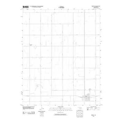
2010 Map of Arnett
USGS Topo · Published 2010About this map
The town of Arnett serves as the focal point of this western Oklahoma landscape, situated at the intersection of a vast section-line road grid. The residential and commercial heart of the community is clearly defined by named thoroughfares like Frantz Ave and Robertson Ave, reflecting the town's role as a regional center of gravity. Outside the immediate settlement, the terrain is characterized by the drainage networks of Little Wolf Creek to the east and the branching arms of Willow Creek and Red Bluff Creek to the west. Local history and genealogy are anchored by two distinct burial sites: the Seventh-Day Adventist Cemetery located along N 1770 RD and the Debolt Cemetery situated just northeast of the main town site. The map captures the orderly division of the high plains, where the natural watercourses provide the only interruption to the systematic agricultural and residential layout.
Find a feature on this map
23 named features on this map. Tap any name to fly to it.
Don’t see what you’re looking for? This feature index may not catch every label — zoom into the map to look around manually.
Map Details
Editions of this 2010 Arnett Map
This is the sole edition of this map. No revisions or reprints were ever made.
Other maps of this area

1955 · Woodward
USGS Topo · 1:250,000

1958 · Woodward
USGS Topo · 1:250,000

1969 · Fargo SW
USGS Topo · 1:24,000

1969 · Shattuck
USGS Topo · 1:24,000

1969 · Gage
USGS Topo · 1:24,000

1970 · Arnett
USGS Topo · 1:24,000

1970 · Arnett SE
USGS Topo · 1:24,000

1970 · Harmon SW
USGS Topo · 1:24,000
1970 · Arnett SW
USGS Topo · 1:24,000

1970 · Goodwin
USGS Topo · 1:24,000