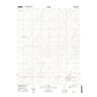
2016 Map of Arnett
USGS Topo · Published 2016About this map
Arnett serves as the focal point of this Ellis County landscape, situated at the junction of several regional routes during the mid-2010s. The settlement pattern is defined by a dense grid of rural roads, such as E0530 Rd and N1800 Rd, which partition the high plains terrain. Local history is anchored by the Debolt Cem near the town center and the Seventh-Day Adventist Cem located further northwest. The natural drainage of the area is carved by several winding waterways, including Willow Cr, Red Bluff Cr, and Little Wolf Cr, which break up the geometric regularity of the section lines. This survey captures the rural infrastructure of western Oklahoma, where the town of Shattuck appears at the northern periphery, connected by an extensive network of north-south and east-west corridors.
Find a feature on this map
48 named features on this map. Tap any name to fly to it.
Don’t see what you’re looking for? This feature index may not catch every label — zoom into the map to look around manually.
Map Details
Editions of this 2016 Arnett Map
This is the sole edition of this map. No revisions or reprints were ever made.
Other maps of this area

1955 · Woodward
USGS Topo · 1:250,000

1958 · Woodward
USGS Topo · 1:250,000

1969 · Fargo SW
USGS Topo · 1:24,000

1969 · Shattuck
USGS Topo · 1:24,000

1969 · Gage
USGS Topo · 1:24,000

1970 · Arnett
USGS Topo · 1:24,000

1970 · Arnett SE
USGS Topo · 1:24,000

1970 · Harmon SW
USGS Topo · 1:24,000
1970 · Arnett SW
USGS Topo · 1:24,000

1970 · Goodwin
USGS Topo · 1:24,000