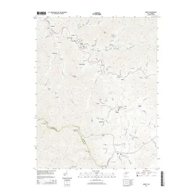
2014 Map of Arnett
USGS Topo · Published 2014About this map
Guyandotte Mountain and the high ridges of the Coal River basin define this portion of the West Virginia coalfields during the early 21st century. The landscape is marked by numerous family-named burial grounds including Bone Cem, Eunice Cem, and Taylor Cem, which remain as essential genealogical anchors for the communities of Arnett, Saxon, and Bolt. Settlement follows the narrow valleys of Marsh Fork and the Coal River, where local history is preserved in landmarks like the Pfc John M. Davis Memorial Bridge and the Ivy Knob Lookout Tower atop Ivy Knob. The map also details the winding paths of WV-3 and WV-99, alongside the Maple Meadow Mining Rd, reflecting the region's long-standing connection to the extraction industry and its complex network of rural hollows.
Find a feature on this map
124 named features on this map. Tap any name to fly to it.
Don’t see what you’re looking for? This feature index may not catch every label — zoom into the map to look around manually.
Map Details
Editions of this 2014 Arnett Map
This is the sole edition of this map. No revisions or reprints were ever made.
Other maps of this area

1891 · Oceana
USGS Topo · 1:125,000

1891 · Raleigh
USGS Topo · 1:125,000

1893 · Oceana
USGS Topo · 1:125,000

1897 · Raleigh
USGS Topo · 1:125,000

1898 · Oceana
USGS Topo · 1:125,000

1902 · Raleigh
USGS Topo · 1:125,000

1910 · Pineville
USGS Topo · 1:48,000

1910 · Bald Knob
USGS Topo · 1:48,000

1911 · Marshes
USGS Topo · 1:48,000

1912 · Mullens
USGS Topo · 1:62,500