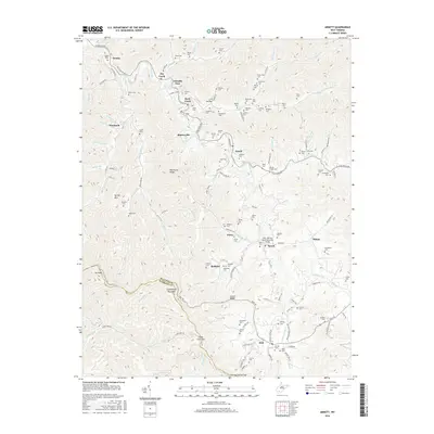
2016 Map of Arnett
USGS Topo · Published 2016About this map
Guyandotte Mountain and the high ridges of the Raleigh County and Wyoming County border define this section of the Appalachian coalfields. The drainage basin of the Marsh Fork river system dictates the settlement pattern, with small communities like Arnett, Saxon, and Posey established along the narrow valley floors. The landscape is densely marked with family cemeteries, such as Scarbroūgh Cem, Pettry Cem, and Sarrett-Lemon Cem, providing a detailed record for genealogical research in these mountain hollows. The local infrastructure, including the PFC John M. Davis Memorial Bridge, reflects the importance of the Coal River Road corridor for connecting these dispersed settlements. Further south, the terrain rises toward Clear Fork Gap and Skinned Poplar Gap, where the map documents the headwaters of the Clear Fork and the rugged divide between the local watersheds.
Find a feature on this map
139 named features on this map. Tap any name to fly to it.
Don’t see what you’re looking for? This feature index may not catch every label — zoom into the map to look around manually.
Map Details
Editions of this 2016 Arnett Map
This is the sole edition of this map. No revisions or reprints were ever made.
Other maps of this area

1891 · Oceana
USGS Topo · 1:125,000

1891 · Raleigh
USGS Topo · 1:125,000

1893 · Oceana
USGS Topo · 1:125,000

1897 · Raleigh
USGS Topo · 1:125,000

1898 · Oceana
USGS Topo · 1:125,000

1902 · Raleigh
USGS Topo · 1:125,000

1910 · Pineville
USGS Topo · 1:48,000

1910 · Bald Knob
USGS Topo · 1:48,000

1911 · Marshes
USGS Topo · 1:48,000

1912 · Mullens
USGS Topo · 1:62,500