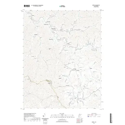
2019 Map of Arnett
USGS Topo · Published 2019About this map
Peachtree Ridge and the winding course of the Coal River define this corner of the West Virginia coalfields, where family-named cemeteries and small settlements follow the narrow creek valleys. This survey documents a deeply rooted landscape where community identity is tied to landmarks like Arnett, Dry Creek, and Rock Creek. Numerous family burial grounds, such as Adkins Cem, Bone Cem, and Jarrell Cem, are scattered across the terrain, reflecting generations of residency in the hollows. The map illustrates how transportation evolved from the water-level routes of Marsh Fork and Millers Fork to modern connections like the PFC John M. Davis Memorial Bridge. These names, including those of smaller hamlets like Posey, Saxon, and Redbird, provide a detailed look at the rural settlement patterns along the border of Raleigh and Wyoming counties.
Find a feature on this map
134 named features on this map. Tap any name to fly to it.
Don’t see what you’re looking for? This feature index may not catch every label — zoom into the map to look around manually.
Map Details
Editions of this 2019 Arnett Map
This is the sole edition of this map. No revisions or reprints were ever made.
Other maps of this area

1891 · Oceana
USGS Topo · 1:125,000

1891 · Raleigh
USGS Topo · 1:125,000

1893 · Oceana
USGS Topo · 1:125,000

1897 · Raleigh
USGS Topo · 1:125,000

1898 · Oceana
USGS Topo · 1:125,000

1902 · Raleigh
USGS Topo · 1:125,000

1910 · Pineville
USGS Topo · 1:48,000

1910 · Bald Knob
USGS Topo · 1:48,000

1911 · Marshes
USGS Topo · 1:48,000

1912 · Mullens
USGS Topo · 1:62,500