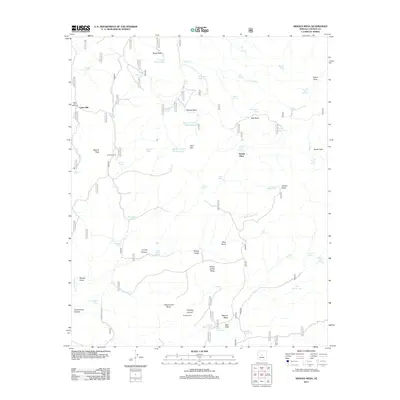
2012 Map of Arnold Mesa
USGS Topo · Published 2012About this map
Arnold Mesa and its neighboring plateaus define this Yavapai County landscape, where water security dictated the placement of early 21st-century outposts. The map documents a network of named springs, tanks, and windmills essential for ranching and survival in the high desert, such as the Cedar Mill Windmill and Joe Best Spring. Evidence of human occupation is scattered across the terrain in the form of isolated structures like Bootleg Cabin, Horner Cabin Spring, and the Arnold Place. Transportation is limited to rugged tracks like Reimer Spring Rd, which connects historical sites including the Reimer Corral. The topographic detail reveals a complex system of drainage and grazing lands, from the deep Cottonwood Canyon to the broad expanse of Yellow Jacket Mesa, providing a clear look at the infrastructure required to maintain a presence in this environment.
Find a feature on this map
68 named features on this map. Tap any name to fly to it.
Don’t see what you’re looking for? This feature index may not catch every label — zoom into the map to look around manually.
Map Details
Editions of this 2012 Arnold Mesa Map
This is the sole edition of this map. No revisions or reprints were ever made.
Other maps of this area

1887 · Verde
USGS Topo · 1:250,000

1887 · Prescott
USGS Topo · 1:250,000

1892 · Verde
USGS Topo · 1:250,000

1892 · Prescott
USGS Topo · 1:250,000

1903 · Bradshaw Mountains
USGS Topo · 1:125,000

1905 · Jerome
USGS Topo · 1:125,000

1923 · Camp Verde
USGS Topo · 1:125,000

1929 · Turret Peak
USGS Topo · 1:125,000

1932 · Camp Verde
USGS Topo · 1:125,000

1933 · Turret Peak
USGS Topo · 1:125,000