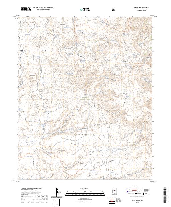
2023 Map of Arnold Mesa
USGS Topo · Published 2023About this map
Cedar Mill and the expansive drainage of Cienega Creek anchor this high-desert landscape in the central Arizona uplands. The terrain is characterized by a series of prominent plateaus and seasonal water catchments, including Arnold Mesa, Yellow Jacket Mesa, and Marlow Mesa. These elevated features are separated by deep-cut geographic markers such as Arnold Canyon and Reimer Draw, illustrating the complex erosion patterns of the region. The map details a sophisticated network of stock tanks, such as Box T Tank, Wells Spring, and Hog Basin Tank, which were vital for managing livestock across the arid ranges of the Prescott National Forest and the protected Cedar Bench Wilderness. Peaks like Reimer Peak and Porcupine Mtn provide essential topographic reference points for this sparsely settled ranching and wilderness area.
Find a feature on this map
78 named features on this map. Tap any name to fly to it.
Don’t see what you’re looking for? This feature index may not catch every label — zoom into the map to look around manually.
Map Details
Editions of this 2023 Arnold Mesa Map
This is the sole edition of this map. No revisions or reprints were ever made.
Other maps of this area

1887 · Verde
USGS Topo · 1:250,000

1887 · Prescott
USGS Topo · 1:250,000

1892 · Verde
USGS Topo · 1:250,000

1892 · Prescott
USGS Topo · 1:250,000

1903 · Bradshaw Mountains
USGS Topo · 1:125,000

1905 · Jerome
USGS Topo · 1:125,000

1923 · Camp Verde
USGS Topo · 1:125,000

1929 · Turret Peak
USGS Topo · 1:125,000

1932 · Camp Verde
USGS Topo · 1:125,000

1933 · Turret Peak
USGS Topo · 1:125,000