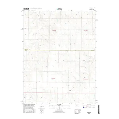
2015 Map of Arnold
USGS Topo · Published 2015About this map
Arnold sits at the intersection of Ness and Trego counties, serving as the primary anchor for this stretch of the High Plains. The landscape is defined by a dendritic network of seasonal waterways, including Wild Horse Cr and Sand Cr, which cut through the agricultural sections. For those researching family history in the region, the presence of the Amish Cem and Arnold Cem provides specific points of interest within the rural township boundaries. The map illustrates a strictly organized grid of county roads, such as Co Rd 270 and EE Rd, which dictate the movement of people and goods through these plains. This late-stage survey preserves the names of smaller drainage features like Gibson Cr and Rattlesnake Cr, which are essential for understanding the local topography and historical land use in this part of western Kansas.
Find a feature on this map
36 named features on this map. Tap any name to fly to it.
Don’t see what you’re looking for? This feature index may not catch every label — zoom into the map to look around manually.
Map Details
Editions of this 2015 Arnold Map
This is the sole edition of this map. No revisions or reprints were ever made.
Other maps of this area

1893 · Ellis
USGS Topo · 1:125,000

1955 · Great Bend
USGS Topo · 1:250,000

1955 · Scott City
USGS Topo · 1:250,000

1957 · Great Bend
USGS Topo · 1:250,000

1958 · Great Bend
USGS Topo · 1:250,000

1958 · Scott City
USGS Topo · 1:250,000

1965 · Utica SW
USGS Topo · 1:24,000
1966 · Ransom SW
USGS Topo · 1:24,000

1966 · Utica SE
USGS Topo · 1:24,000

1974 · Castle Rock
USGS Topo · 1:24,000