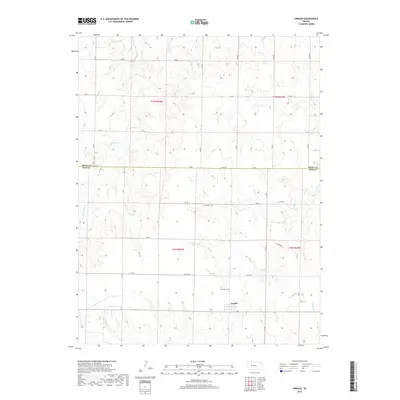
2018 Map of Arnold
USGS Topo · Published 2018About this map
Arnold anchors the southern portion of this High Plains landscape, situated along a section of the county road network that defines the region's agricultural layout. The terrain is marked by a complex system of drainage draws, most notably the seasonal courses of Wild Horse Cr and Sand Cr. These watercourses create a distinct topographic texture against the gridded precision of the local thoroughfares like Co Line Rd and Ee Rd.
Find a feature on this map
24 named features on this map. Tap any name to fly to it.
Don’t see what you’re looking for? This feature index may not catch every label — zoom into the map to look around manually.
Map Details
Editions of this 2018 Arnold Map
This is the sole edition of this map. No revisions or reprints were ever made.
Other maps of this area

1893 · Ellis
USGS Topo · 1:125,000

1955 · Great Bend
USGS Topo · 1:250,000

1955 · Scott City
USGS Topo · 1:250,000

1957 · Great Bend
USGS Topo · 1:250,000

1958 · Great Bend
USGS Topo · 1:250,000

1958 · Scott City
USGS Topo · 1:250,000

1965 · Utica SW
USGS Topo · 1:24,000
1966 · Ransom SW
USGS Topo · 1:24,000

1966 · Utica SE
USGS Topo · 1:24,000

1974 · Castle Rock
USGS Topo · 1:24,000