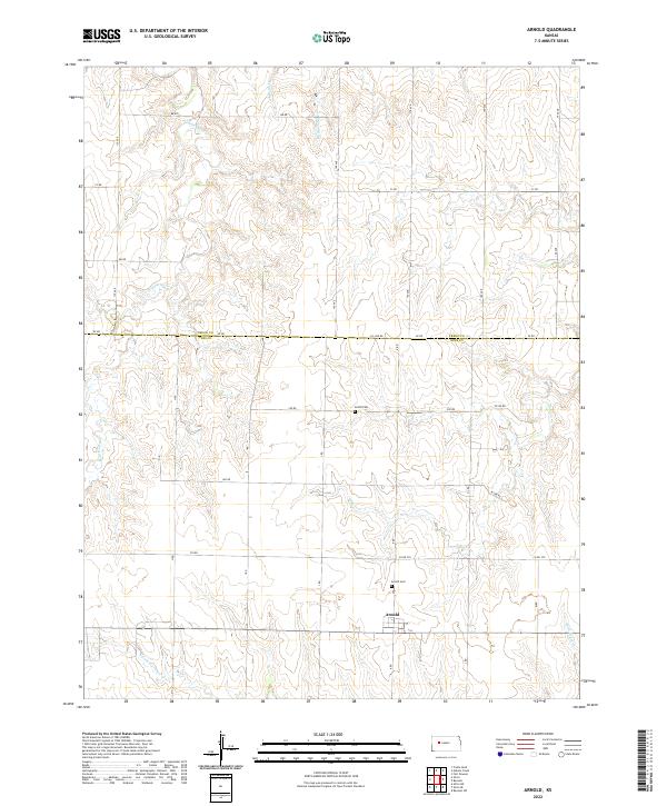
2022 Map of Arnold
USGS Topo · Published 2022About this map
Arnold sits at the junction of the section-line roads in this western Kansas landscape, serving as a focal point for the surrounding Ness and Trego County borderlands. The terrain is defined by a dendritic network of drainage systems, including Wild Horse Cr and Gibson Cr, which carve through the high plains. A significant cultural marker is the Amish Cem located along 290 RD, indicating the localized religious and community history of this rural area. The map illustrates a strictly organized grid of agricultural development, where routes like Ee RD and Co Line RD trace the legal boundaries between townships. In the southern portion of the sheet, the Arnold Cem and the headwaters of N Fork Forrester Cr highlight the sparse but deliberate placement of infrastructure in an area dominated by open range and dryland farming.
Find a feature on this map
36 named features on this map. Tap any name to fly to it.
Don’t see what you’re looking for? This feature index may not catch every label — zoom into the map to look around manually.
Map Details
Editions of this 2022 Arnold Map
This is the sole edition of this map. No revisions or reprints were ever made.
Other maps of this area

1893 · Ellis
USGS Topo · 1:125,000

1955 · Great Bend
USGS Topo · 1:250,000

1955 · Scott City
USGS Topo · 1:250,000

1957 · Great Bend
USGS Topo · 1:250,000

1958 · Great Bend
USGS Topo · 1:250,000

1958 · Scott City
USGS Topo · 1:250,000

1965 · Utica SW
USGS Topo · 1:24,000
1966 · Ransom SW
USGS Topo · 1:24,000

1966 · Utica SE
USGS Topo · 1:24,000

1974 · Castle Rock
USGS Topo · 1:24,000