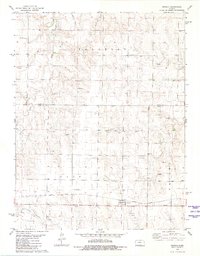
1981 Map of Arnold
USGS Topo · Published 1981About this map
Arnold sits at the center of this western Kansas landscape, a community defined by the path of the Missouri Pacific railroad and the surrounding agricultural grid. The map reveals a transition between the northern Franklin township and the southern Ohio and Nevada districts, where a complex network of ephemeral watercourses like Wild Horse Creek and Rattlesnake Creek cut through the high plains. Of particular interest to genealogists and local historians are the Amish Cem and the Arnold Cem, situated near active oil field developments that became a hallmark of the regional economy by the 1970s. The presence of numerous Sandpit sites and scattered Oil Well markers among the section lines illustrates the dual reliance on natural resource extraction and dryland farming during this era.
Find a feature on this map
19 named features on this map. Tap any name to fly to it.
Don’t see what you’re looking for? This feature index may not catch every label — zoom into the map to look around manually.
Map Details
Editions of this 1981 Arnold Map
This is the sole edition of this map. No revisions or reprints were ever made.
Other maps of this area

1893 · Ellis
USGS Topo · 1:125,000

1955 · Great Bend
USGS Topo · 1:250,000

1955 · Scott City
USGS Topo · 1:250,000

1957 · Great Bend
USGS Topo · 1:250,000

1958 · Great Bend
USGS Topo · 1:250,000

1958 · Scott City
USGS Topo · 1:250,000

1965 · Utica SW
USGS Topo · 1:24,000
1966 · Ransom SW
USGS Topo · 1:24,000

1966 · Utica SE
USGS Topo · 1:24,000

1974 · Castle Rock
USGS Topo · 1:24,000