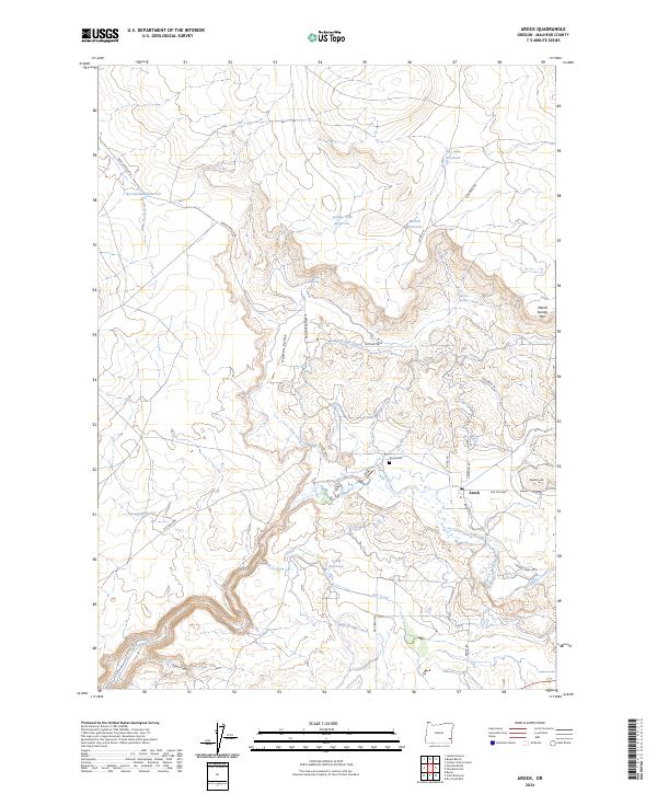
2024 Map of Arock
USGS Topo · Published 2024About this map
Arock stands as a small ranching hub in Malheur County, situated along the Old Ion Hwy where the landscape transitions into the high desert plains. This modern survey illustrates a sophisticated network of water management essential for the arid environment, featuring the North Side Canal and South Side Canal which divert resources toward various impoundments. The terrain is marked by distinctive local landmarks such as Hidden Valley and Merrill Springs Rim, reflecting a geography shaped by both volcanic basalt and seasonal water flow.
Find a feature on this map
35 named features on this map. Tap any name to fly to it.
Don’t see what you’re looking for? This feature index may not catch every label — zoom into the map to look around manually.
Map Details
Editions of this 2024 Arock Map
This is the sole edition of this map. No revisions or reprints were ever made.
Other maps of this area

1955 · Jordan Valley
USGS Topo · 1:250,000

1955 · Boise
USGS Topo · 1:250,000

1957 · Jordan Valley
USGS Topo · 1:250,000

1958 · Boise
USGS Topo · 1:250,000

1958 · Jordan Valley
USGS Topo · 1:250,000

1962 · Boise
USGS Topo · 1:250,000

1969 · Jordan Craters South
USGS Topo · 1:24,000
1969 · Threemile Hill
USGS Topo · 1:24,000
1969 · Dry Creek Rim
USGS Topo · 1:24,000

1972 · Owyhee Butte
USGS Topo · 1:24,000